Téléphone : +41 22 757 67 57 frontdesk@dev.destination-montagne.ch

[:fr]Descente vers [:en]Descent to [:de]Abstieg nach [:]Kandersteg

[:fr]

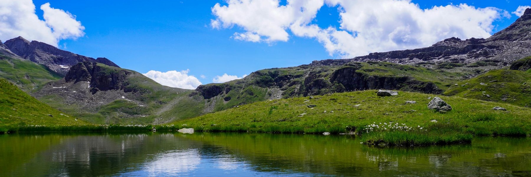
Au-delà de l’intérêt de la randonnée, le versant bernois du Col de la Gemmi est digne d’intérêt que ce soit au niveau historique qu’au niveau géologique.

Il faut d’abord mentionner que le cheminement principal (au sens historique) descend de la Gemmi suit la rive droite du Daubensee, traverse de flanc la Winteregg avant de rejoindre Kandersteg. Néanmoins, et malgré le fait que cet autre sentier présente des à pic important, le cheminement vers le Gasterntal a également été utilisé depuis les temps reculés. Il franchit le Gurnigel, qui est sur les cartes modernes, indiqué comme étant le passage dans la paroi sous le Tatelishore. Toutefois, au moyen-âge, tous les pâturages, incluant ceux de la Spittelmatte, étaient désignés comme étant le Gurgnigel. Le toponyme de Spittelmatte (le pâturage de l’hospice), sous-entend qu’il devait se trouver à cet endroit un établissement accueillant les voyageurs traversant la Gemmi. Si aucune trace d’un tel bâtiment a été retrouvée, c’est que l’endroit se trouve juste en-dessous de l’Altels duquel se sont détachés plusieurs éboulements et chute de séracs.

Un fait intéressant doit également être souligné : la frontière cantonale ne suit pas la crête de montagne du Col de la Gemmi, mais se trouve bien plus loin sur le versant bernois. Cela explique le fait que l’auberge de Schwarenbach se trouve entièrement sur territoire valaisan.

Le Gasterntal, magnifique vallée alpine, vaut que l’on y descende par le Gurnigel depuis la Gemmi afin de la rejoindre. Malgré l’aspect sauvage, cette vallée a été la cause d’une tragédie survenue lors du percement du premier tunnel du Lötschberg au début du 20ème siècle. En effet, on croyait alors que dès que l’on aurait commencé à creuser la roche près de Kandersteg, que l’on resterait dans la roche-mère. C’était sans compter que le fond du Gasterntal est rempli de 200m d’eau et de gravats. Ainsi, lorsque les ouvriers avaient traversé la roche pour atteindre le Gasterntal, un éboulement de gravats et d’eau s’était produit, emportant les ouvriers. À la suite de cette tragédie, des fontis s’étaient formés dans le fond de la vallée et on avait évalué plusieurs solutions, une consistant à geler le sol environnant le tunnel afin de pouvoir le percer en toute sécurité. La solution finalement adoptée a consisté à creuser le tunnel en longeant la Gasterntal pour traverser celle-ci beaucoup plus en amont. C’est ainsi qu’en regardant les cartes topographiques, ont peut se rendre compte que les débuts de tunnels aux deux entrées sont parfaitement alignés, mais que le tunnel effectue un évitement en direction de l’est.

Ici, nous avions suivi la rive gauche du Daubensee qui, même si elle ne correspond pas à l’itinéraire historique, est nettement moins fréquentée. Au bout du Daubensee, on retrouve le sentier officiel, et on ne tarde pas à passer devant l’auberge de Schwarenbach. Cette auberge est l’objet d’une nouvelle de Guy de Maupassant qui avait été publiée dans un recueil s’intitulant « le Horla ». La précision des descriptions fait penser que de Maupassant avait traversé la Gemmi et avait entendu l’histoire lui ayant inspiré sa nouvelle.

Après avoir passé Schwarenbach, on ne tarde pas à rejoindre une grande plaine, la Spittelmatte. C’est près de celle-ci que se trouve la frontière cantonale. Un peu plus loin, on suit le Schwarzbach afin de descendre à travers Gurnigel vers le Gasterntal. Cet endroit est le seul où j’aie pu voir des Ancolies des Alpes. Là, il était trop tard dans la saison pour pouvoir en voir.

Une fois dans le fond du Gasterntal, on suit la Kander pour atteindre Kandersteg. A cause de la chaleur qui régnait ces jours-là, ce torrent s’était transformé en eaux rugissantes et les abords de celles-ci me rappellent le souvenir du tableau de Calame « Orage à la Handeck ».

Itinéraire : Col de la Gemmi – rive gauche du Daubensee – Schwarenbach – Spittelmatte – Gurnigel – Chluse – Eggeschwand
Distance : 14,5Km
Dénivellation : 160m positifs/1305m négatifs
Durée : 4h30

[:en]

Beyond the interest of hiking, the Bernese side of the Gemmipass is worth of interest both historically and geologically.

It should first be mentioned that the main route (in the historical sense) descends from the Gemmi, follows the right bank of the Daubensee, crosses the Winteregg sideways before reaching Kandersteg. Nevertheless, and even though this other path has significant steep slopes, the path towards the Gasterntal has also been used since ancient times. It crosses the Gurnigel, which is on modern maps marked as the passage in the wall below the Tatelishore. However, in the Middle Ages, all pastures, including those of Spittelmatte, were referred to as Gurgnigel. The toponym of Spittelmatte (the hospice pasture) implies that there must have been there an establishment welcoming traveler crossing the Gemmi. If no trace of such a building has been found, it is because the place is located just below the Altels from which several landslides and serac falls occurred.

An interesting fact should also be highlighted: the cantonal border does not follow the mountain ridge of the Gemmipass but is located much further on the Bernese side. This explains the fact that the Schwarenbach inn is located entirely on Valais territory.

The Gasterntal, a magnificent Alpine valley, is worth descending via the Gurnigel from the Gemmi to reach it. Despite its wild appearance, this valley was the cause of a tragedy that occurred during the drilling of the first Lötschberg tunnel at the beginning of the 20th century. Indeed, it was then believed that as soon as they started digging the rock near Kandersteg, they would remain in the bedrock. This was without considering that the bottom of the Gasterntal is filled with 200m of water and rubble. Thus, when the workers crossed the rock to reach the Gasterntal, a landslide of rubble and water occurred, carrying the workers. Following this tragedy, cave-ins had formed in the bottom of the valley and several solutions were evaluated, one consisting of freezing the ground surrounding the tunnel so that it could be drilled safely. The solution ultimately adopted consisted of digging the tunnel along the Gasterntal to cross it much further upstream. This is why, by looking at the topographical maps, one realizes that the beginnings of the tunnels at the two entrances are perfectly aligned, but that the tunnel avoids towards the east.

Here we followed the left bank of the Daubensee which, even if it does not correspond to the historic route, is significantly less frequented. At the end of the Daubensee, we find the official path, and it doesn’t take long to pass the Schwarenbach inn. This inn is the subject of a short story by Guy de Maupassant which was published in a collection entitled “le Horla”. The precision of the descriptions suggests that de Maupassant had crossed the Gemmi and heard about what inspired his short story.

After passing Schwarenbach, it does not take long to reach a large plain, the Spittelmatte. It is near this that the cantonal border is located. A little further on, we follow the Schwarzbach to descend through Gurnigel towards the Gasterntal. This place is the only one where I have been able to see Alpine Columbines. There, it was too late in the season to be able to see any.

Once at the bottom of the Gasterntal, we follow the Kander to reach Kandersteg. Because of the heat that reigned those days, this torrent had transformed into roaring waters and the surroundings of these remind me of Calame’s painting “Thunder at the Handeck”.

Route: Gemmi Pass – left bank of the Daubensee – Schwarenbach – Spittelmatte – Gurnigel – Chluse – Eggeschwand
Distance: 14.5Km
Altitude gain: 160m positive/1305m negative
Duration: 4h30

[:de]

Über das Wanderinteresse hinaus ist der Berner Hang des Gemmipasses sowohl historisch als auch geologisch interessant.

Zunächst ist zu erwähnen, dass die Hauptroute (im historischen Sinne) die von der Gemmi absteigt, dem rechten Ufer des Daubensees folgt, seitlich die Winteregg überquert und schliesslich Kandersteg erreicht. Dennoch und trotz der Tatsache, dass dieser andere Weg erhebliche Abgründe aufweist, wurde der Weg ins Gasterntal auch schon seit der Antike genutzt. Er quert den Gurnigel, der auf modernen Karten als Durchgang in der Felswand unterhalb der Tatelishore markiert ist. Als Gurgnigel wurden jedoch im Mittelalter alle Weiden, auch jene der Spittelmatte, bezeichnet. Der Ortsname Spittelmatte (Hospizweide) deutet darauf hin, dass es dort einen Gasthof gegeben haben muss, der Reisende über die Gemmi willkommen hiess. Wenn keine Spur eines solchen Gebäudes gefunden wurde, liegt das daran, dass der Ort direkt unterhalb des Altels liegt, von dem aus es zu mehreren Stein- und Eisschläge kam.

Hervorzuheben ist auch eine interessante Tatsache: Die Kantonsgrenze folgt nicht dem Bergrücken des Gemmipasses, sondern liegt viel weiter unten auf Berner Seite. Dies erklärt die Tatsache, dass das Gasthaus Schwarenbach vollständig auf Walliser Boden liegt.

Um von der Gemmi aus über den Gurnigel ins Gasterntal zu gelangen, lohnt es sich, in dieses herrliche Alpental abzusteigen. Trotz seines wilden Aussehens war dieses Tal der Auslöser einer Tragödie, die sich beim Bohren des ersten Lötschbergtunnels zu Beginn des 20. Jahrhunderts ereignete. Tatsächlich glaubte man damals, dass man, sobald man mit dem Ausheben des Felsens in der Nähe von Kandersteg begann, im Muttergestein bleiben würden. Dabei wurde nicht berücksichtigt, dass die Talsohle des Gasterntals mit 200 m Wasser und Geröll gefüllt ist. Als die Arbeiter den Felsen durchbohrten, um ins Gasterntal zu gelangen, kam es zu einer Flut aus Geröll und Wasser, der die Arbeiter mit sich riss. Nach dieser Tragödie hatten sich in der Talsohle Einstürze gebildet und es wurden mehrere Lösungen geprüft, eine davon bestand darin, den Boden rund um den Tunnel einzufrieren, damit er sicher gebohrt werden konnte. Die Lösung bestand schliesslich darin, den Tunnel entlang des Gasterntals zu bohren, um es viel weiter flussaufwärts zu umgehen. Auf diese Weise können wir anhand der topografischen Karten erkennen, dass die Tunnelanfänge an den beiden Eingängen perfekt ausgerichtet sind, der Tunnel jedoch nach Osten ausweicht.

Hier folgten wir dem linken Ufer des Daubensees, der, auch wenn er nicht der historischen Route entspricht, deutlich weniger begangen ist. Am Ende des Daubensees finden wir den offiziellen Weg und es dauert nicht lange, bis man am Gasthof Schwarenbach vorbeikommt. Dieses Gasthaus ist Gegenstand einer Kurzgeschichte von Guy de Maupassant, die in einer Sammlung mit dem Titel „le Horla“ veröffentlicht wurde. Die Genauigkeit der Beschreibungen lässt darauf schliessen, dass de Maupassant die Gemmi überquerte und die Geschichte gehört hatte, die ihn zu seiner Kurzgeschichte inspirierte.

Nach dem Vorbeikommen von Schwarenbach dauert es nicht lange, bis man eine grosse Ebene, die Spittelmatte, erreicht. In dessen Nähe verläuft die Kantonsgrenze. Etwas weiter folgt man dem Schwarzbach und steigt über den Gurnigel ins Gasterntal ab. Dieser Ort ist der einzige, an dem ich Alpen-Akeleien sehen konnte. Doch war es zu spät in der Saison, um noch welche sehen zu können.

Unten im Gasterntal angekommen folgt man der Kander bis nach Kandersteg. Aufgrund der Hitze, die dann herrschte, hatte sich dieser Wildbach in tosendes Wasser verwandelt und die Umgebung erinnerte mich an Calames Gemälde „Gewitter auf der Handeck“.

Route: Gemmipass – linkes Daubenseeufer – Schwarenbach – Spittelmatte – Gurnigel – Chluse – Eggeschwand
Distanz: 14,5 km
Höhe: 160 m positiv/1305 m negativ
Dauer: 4h30

[:]

Laisser un commentaire

Votre adresse e-mail ne sera pas publiée. Les champs obligatoires sont indiqués avec *