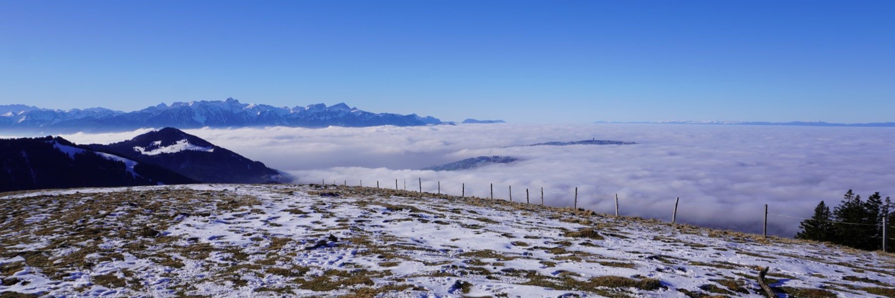
Hier wechsle ich mal die Kulisse. Die Wanderung, die wir hier durchgeführt haben, spielt sich in den österreichischen Bregenzerwälder Voralpen ab. Diese liegen nur wenige Kilometer von der Schweizer Grenze entfernt und bieten eine Landschaft, die sich nicht ganz so stark von dem unterscheidet, was wir gewohnt sind. Allerdings sind die Unterkünfte sehr gut und die Gastfreundschaft herzlich, was den Bregenzerwald zu einem schönen Wanderziel macht. Zudem liegt der Bregenzerwald etwas abseits der grossen Verkehrswege und insbesondere der Täler, die zum Arlberg führen. So ist es dort auch ruhig, auch wenn es an einigen Stellen recht belebt ist.
Der Gipfel der Sünser Spitze liegt etwas abseits des Skigebiets von Damüls, auch wenn es ein Nachbarberg ist. Zudem ist er ein guter Gipfel, da er höher liegt als der über dem Rheintal thronende Nachbarberg, der Hohe Freschen. So bietet sich eine gute Aussicht, die bis zum Alpstein und zum Tödi reicht. Auch der charakteristische Gipfel, den man auch als Montafoner Matterhorn bezeichnet, der Zimba, ist zu sehen.
Der Ausgangspunkt der Wanderung liegt etwas unterhalb an der Strasse, die zum Furkajoch führt. Dort gibt es einen kostenlosen Parkplatz (es ist jedoch darauf hingewiesen, dass dort nicht übernachten erlaubt ist). Der Name Furkajoch ist ein schönes Beispiel für einen Pleonasmus und bedeutet so viel wie “Furka-Pass”. Da Furka aber bereits eine Passbezeichnung ist, bedeutet es so viel wie “Pass-Pass”.
Fast gegenüber dem Parkplatz führt ein guter Wanderweg entlang des Hanges hinauf zur Portlaalpe. Etwas höher erreicht man einen kleinen Pass, von wo aus einem kleinen Wanderweg hinauf zum Portlakopf führt, von wo aus man eine gute Aussicht auf die umliegenden Gipfel, insbesondere den Glatthorn, hat. Vom Portlakopf aus sind wir entlang des Grates, der an einigen Stellen etwas steil ist, hinauf zum Portlahorn und zum Sünser Joch gewandert. Vom Sünser Joch aus führt der normale Wanderweg hinauf zum Grat, wir haben uns jedoch für einen Wanderweg entschieden, der unterhalb des Grates entlangführt. Auf dem Weg zum Gipfel der Sünser Spitze haben wir den Grat erreicht und sind entlang des Grates hinauf zum Gipfel gewandert.
Auf dem Gipfel waren wir nicht allein, aber die Gespräche mit den Einheimischen waren sehr nett. Vom Gipfel aus sind wir entlang des Südgrates hinab zum Sünser See gewandert. Von der Portlaalpe sind wir über die Sünsalpe wieder zurück zum Furkajoch und der Furkajochstrasse.
Route: Parkplatz an der Furkajochstrasse – Portlaalpe – Portlakopf – Portlahorn – Sünser Joch – Sünser Spitze – Sünser See – Sünsalpe – Portlaalpe – Ausgangspunkt
Distanz: 10.5 km
Höhenunterschied: 575 m
Dauer: 4h30
