The valley leading to Les Verrières from Fleurier is closed by a chasm separating the latter town from Saint-Sulpice. This chasm has two spurs facing each other. On one side is the one called Napoleon’s Hat, on which stands a restaurant that has now been converted into a factory (the situation could be worse). In front of it is another spur with a flag flying on it. Every time I passed Fleurier, I noticed this flag and from the map I noticed that there was a trail passing it. I had also heard about the Monlési ice cave and had realized, while planning my hike, that a detour to this flowstone cave was manageable.
From Fleurier Station, one crosses a bridge of a respectable size to reach the small neighborhood below the rocks and the railway track. The signs then lead to the roundabout of the main road, near which one begins the climb through the woods. In these woods is the educational trail of la Caroline, which explains the successes and failures of the reforestation initiatives that followed the construction of the railway line. At that time, there was no special consideration about the disposal of spoil: everything was dumped down the slope.
After passing near the entrance of the tunnel, things begin to get serious. First, one must climb the tunnel gate by stairs before crossing steep slopes towards the Signal. A few slightly dizzy passages are equipped with a handrail. To reach the Signal, one must go down a little. We then arrive at the platform on which the famous flag is located.
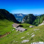
The rest of the trail is much quieter and there are no more steep slopes to cross. Only the trail layout is a bit confusing, as one expects to climb directly to the corner of the mountain. In fact, one crosses below the pastures long enough to return to the corner. Once one reaches the pastures, the atmosphere changes completely. One is then in pastures on a kind of high plateau.
Near the Grands Prés, just follow the signposted route that quickly reaches the “Vy aux Moines”. Following this route for about 100 meters to the north, one reaches a dry-stone wall. Although there are no trails on the map, there are traces that allow one to cross the pastures towards the Monlési ice cave. The day I made the hike, the farmer had been mowing and collecting hay time ago. I can imagine that earlier in the season, one must be careful not to trample the grass too much.
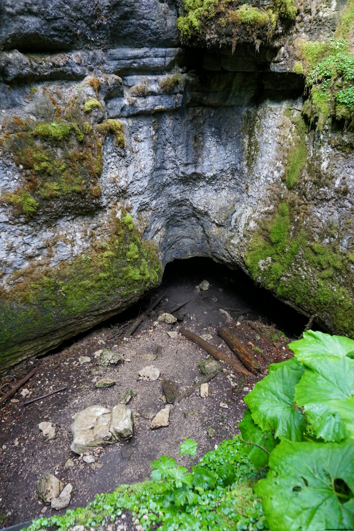
At the end of the pasture there is a forest road that leads very close to the pit. The Monlési ice cave is, as indicated on the sign, a dynamic ice grotto. This means that air currents contribute to the creation of ice. There is another type of ice cave, called static, in which ice is formed by snow accumulation (such as the St. George ice grotto).
From the ice cave, I retraced my steps for a few meters to cut through pastures and reach the Signal des Français. This is a small peak from which one enjoys a 360 degree view.
On the way down to Boveresse, one sees in the distance the magnificent Monlesi building, which is a historical monument. It is near this building that one passes by a cross mentioning the Countess and the Count of Wesdehlen.
Route: Fleurier – Signal – Haut de la Vy – Grands Prés – Monlési Glacier – Signal des Français – Boveresse – Fleurier
Distance: 15Km
Altitude gain: 560m
Duration: 5h


 Previous Post
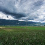 Next Post