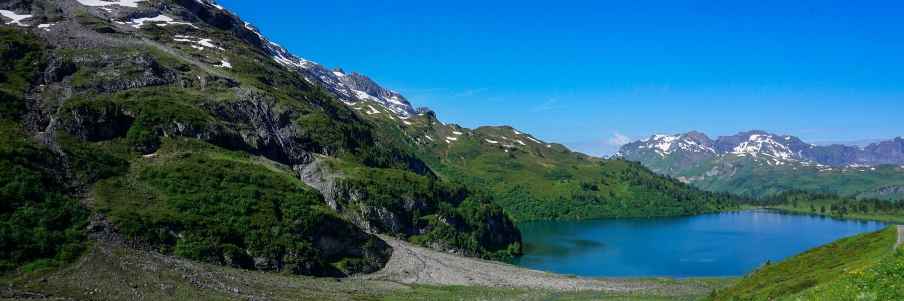
The Gantrisch is a summit, but also a region to which the summit gave its name. This region extends between the Schwarzsee and the Aare valley and includes several peaks, the best known of which, on the edge of the region, is the Stockhorn. The latter can be climbed easily by taking the cable car from Reidenbach in the Simmental. The entire Gantrisch region is a magnificent destination in the Prealps of the canton of Bern. You can access this region in several ways: by leaving from the Sense or by joining the municipality of Rüschegg.
As it was Pentecost Monday and the weather was forecast to be fine, I had decided to avoid the Gurnigel Pass road, very popular for bikers. That’s why I went to Eywald (departure from the Rüschegg ski lift) because you can easily park there.
Rüschegg is a municipality with a relatively dark history. Indeed, there are not many possibilities of exploiting the land, since it is very uneven, with deep ravines prohibiting cultivation or breeding. This is why the inhabitants of this municipality still have a bad reputation and “Rüschegger” is often synonymous with beggar and vagabond.
By doing this hike you cross this rugged terrain, and you often must descend into a narrow valley to go up opposite.
From the Eywald car park (next to which there is a swimming pool), follow a good road passing under the ski lift departure station. You climb in this way to pass above the house of Chreutli and again descend to cross three streams. For crossing the last one, the Wyssbach, there is no bridge, and you must wade through. This crossing could become very problematic in the event of a storm. Beyond, we climb a little to reach the forest hut of Habstanne. After the hut, we soon change direction to go up one end of the Seligrabe and reach the Schwarzstäg footbridge. This place is aptly named (the black ford), because we are at the bottom of the Seligrabe where the sun penetrates only with difficulty.
After a short climb you reach the Gurnigelpass road, just opposite of the Gurnigelbad hotel. This hotel, which currently serves as accommodation for refugees, has had some success for its sulphurous water baths. This water is collected above the Stockhütte, next to which we pass, and the smell of rotten eggs is very marked in the woods overlooking this chalet.
Higher up, the path crosses a forest by making switchbacks. It is at the end of the forest that one emerges in the pastures not far from the Obere Gurnigel. It is worth going to the geodetic signal and following the ridge: the view of Thun and the Bernese Alps is splendid.
Continuing, while following the ridge and bypassing the Zigerhubel, it does not take long to reach the Gurnigelpass road. The contrast is then striking. Although we heard the noise of the engines throughout the climb, it is difficult to anticipate the people we will meet.
By following the ridge, you can then climb the Selibüel which offers a beautiful panorama of the whole region, from the region of Bern to the last peaks of Gantrisch. Only the peaks surrounding the Schwarzsee are not visible, as they are hidden by the trees. Even if the path is not marked, you can easily descend to the northwest to reach the small Selibüelsattel pass. Not far from this pass, a steep and rugged forest path descends the hillside in the direction of Lischbode. Following the forest path, you pass alternately through forest and clearings to reach the pastures of Gross Louetli.
From this chalet, simply follow the paved road crossing the housing estate to reach the starting point.
Itinerary: Eywald (Rüschegg) – Gurtneren – Habstanne – Schwarzstäg – Gurnigelbad – Stockhütte – Obere Gurnigel – Gurnigel Berghütte – Gurnigelpass – Selibüel – Selibüelsattel – Schwire – Gross Louetli – Gustern – Eywald (Rüschegg)
Distance: 18.2km
Altitude gain: 960m
Duration: 6h


 Previous Post
 Next Post