The Combe-Grède is a surprising place. Apart from the fact that it is a Nature Reserve and a Federal Hunting Reserve, and therefore a protected area, the trail that goes up the gorge holds many surprises. Indeed, in many places as you go up the gorge, the continuation of the trail is not obvious. Sometimes you feel like you’re in a dead end, a rocky cirque of impassable walls. And it’s only when you’re at the foot of the walls that the continuation becomes clear.
Four years ago, when I first climbed Combe-Grède, the trail had not yet been prepared for the season. In winter, the railings are removed to prevent damage to them. At that time, the maps did not really indicate that the trail was closed. This has changed considerably because of a few tragic accidents.
To reach the bottom of the Combe-Grède you have the choice of leaving either Villeret or Saint-Imier. The two alternatives are equivalent, but I prefer the one from Saint-Imier, because two trains stop there per hour, compared to only one in Villeret.
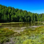
From the Saint-Imier station, you begin by descending to cross the Suze River next to the manufacture of the Longines. This is followed by a crossing of the slope to reach the bottom of the Combe-Grède. At the start of the Combe-Grède, a tightening requires the trail to follow very close to the bed of the stream. As it is often dry, this is not a problem. In the event of flooding, it could very quickly become unpleasant.
After a while, you reach a point where the vale widens. The trail then climbs steeper to reach the bottom of the difficulties. A first small ladder hints us that it will become a little more serious. Higher up, two large ladders allow you to climb up the bottom of the gorge to the foot of the walls, before starting to the left to gain height by means of switchbacks. You return to the bottom of the gorge before starting again to the left. After the last switchbacks, the difficulties, and the atmosphere change abruptly, just before reaching Pré aux Auges.
Following south, one continues to climb the end of the vale and join the road of Col du Chasseral, just below the Métairie de Saint-Jean. One crosses the road twice before crossing in an uphill direction to a small pass not far from the Hôtel du Chasseral. It is easy to spot the top of the Chasseral: it is right at the foot of the enormous tower. To reach it, you can easily follow the asphalt road: motorized traffic is prohibited.
To descend from Le Chasseral to La Neuveville, you must first return to the Hôtel du Chasseral and following the trail that passes by the Metairie de Neuveville. This trail then crosses alternating forests and pastures to reach the Moulin Navilot and Lignières. Below this village, you enter the Combe de Lignières gently downhill for a good kilometer. When the slope becomes steeper, the name changes to Combe du Pilouvi and a nice trail follows the Ruisseau de Vaux. Normally, you can admire some beautiful waterfalls. Here, the stream was dry, and the atmosphere was less picturesque.
Below Schlossberg Castle, you cross the vineyards to reach the old town of La Neuveville. You enter it by passing under the Tour Rouge. After crossing the old town on Rue du Marché, you exit through the magnificent door of the Tower de Rive. This door is just a stone’s throw from La Neuveville train station.
Route: Saint-Imier – Combe Grède – Chasseral – Hôtel du Chasseral – Lignières – Combe du Pilouvi – La Neuveville
Distance: 21.2Km
Altitude gain: 970m
Duration: 7h


 Previous Post
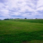 Next Post